The Integrated Global Greenhouse Gas Information System (IG3IS), an initiative under the World Meteorological Organization (WMO), has successfully concluded its Urban Greenhouse Gas Monitoring Webinar Series 2026. Moderated by Vanessa Monteiro (Postdoctoral Researcher at ICTA-UAB and a Steering Committee member of the WMO-IG3IS), this five-part series brought together leading scientists, urban planners, and policy experts from around the globe to share practical strategies for quantifying and managing greenhouse gas (GHG) emissions in cities.
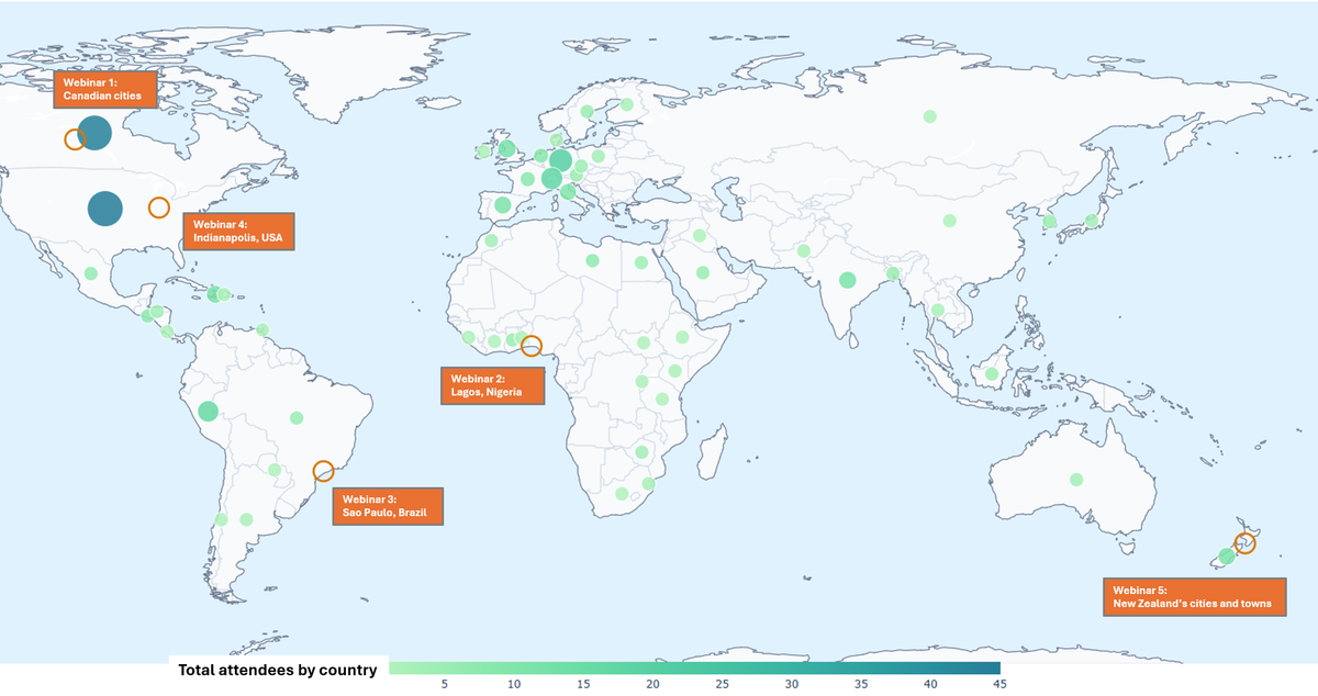
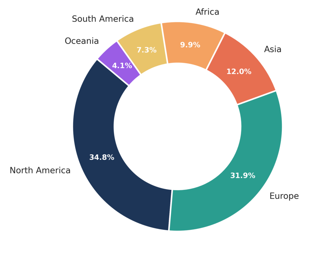
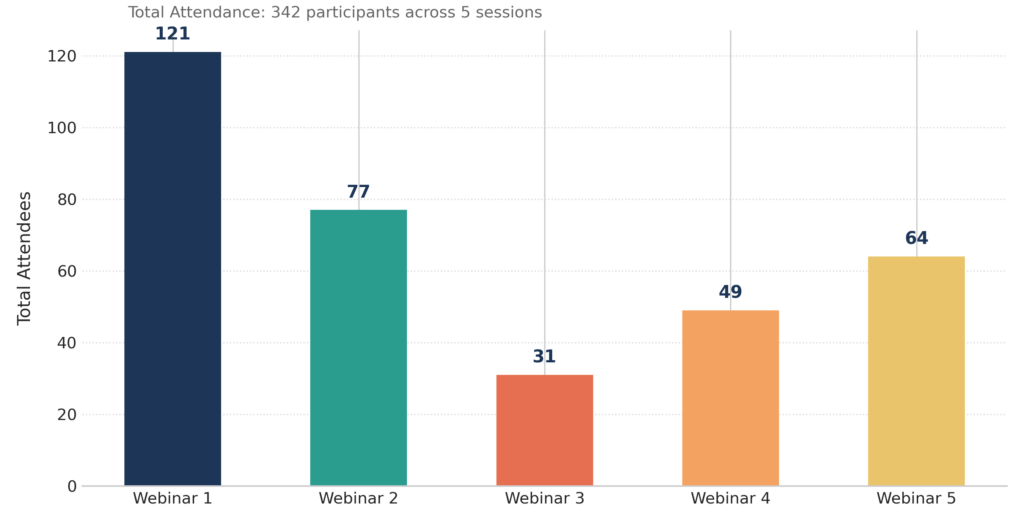
The series engaged 342 total participants across all five sessions, reflecting strong international demand for urban climate monitoring solutions. Engagement was truly global, led by strong participation from North America (34.8%) and Europe (31.9%). The remaining reach spanned Asia (12.0%), Africa (9.9%), South America (7.3%), and Oceania (4.1%).
Overall, the series generated strong interest with over 100 registered participants for each individual webinar.The live attendance peaked during Webinar 1 (121 participants), followed by robust engagement in Webinar 2 (77 participants) and Webinar 5 (64 participants). Webinar 4 and Webinar 3 drew 49 and 31 live attendees, respectively. The varied online attendance could be, in part, related to the differing schedule session times.
The 2026 series highlighted a diversity of monitoring systems, methodological frameworks, and geographic contexts, spanning North America, West Africa, South America, Europe, and Oceania:
- Mobile Atmospheric Surveys (Canada): Explored mobile platforms and continuous monitoring stations to map methane emissions across Canadian cities, landfills, and industrial zones.
- Developing West African Megacities (Lagos, Nigeria): Addressed the observational challenges in data-sparse environments, evaluating CO2, CH4, N2O, and halocarbons across industrial, commercial, and coastal land uses.
- Megacity Network Infrastructure (São Paulo, Brazil): Presented the METROCLIMA-MASP network, showing how CO2 flux measurements, carbon isotopes, and top-down atmospheric modeling disentangle traffic, biomass burning, and vegetation dynamics in South America’s largest urban area.
- Neighborhood-Scale Flux Observations (Indianapolis, USA): Focused on Eddy Covariance flux techniques for source-specific quantification of neighborhood-scale urban CO2 emissions.
- Nationwide Granular Urban Mapping (New Zealand): Closed the series with New Zealand’s CarbonWatch-Urban initiative, detailing how atmospheric data and modeling deliver granular CO2 emissions information for every town and city across the country.
By showcasing tools ranging from mobile sampling and eddy covariance towers to nationwide modeling and satellite integration, the series demonstrated how tailored atmospheric monitoring systems empower local and national decision-makers to track progress toward global climate mitigation targets.